
Infosearch is a leading provider of LiDAR annotation services for the autonomous vehicle industry.
The technology of LiDAR is becoming a crucial component in the AI world. LiDAR sensors enable machines to see the world in a 3D way and have applications in autonomous vehicles and robotics, smart cities, logistics, mapping, construction, and industrial automation.
Whereas 2D cameras produce images from vertical and horizontal planes, LiDAR systems produce spatial data by estimating the distance between the sensor and objects around it. The data is typically displayed as a 3D point cloud of millions of points that collectively describe roads, vehicles, buildings, people, trees, machinery, and more in the environment.
But raw point cloud data doesn’t necessarily tell an AI system what each object is.
Data has to be annotated, categorized, labeled, etc. in order to train intelligent systems. LiDAR annotation is a key element here.
The industry of annotating LiDAR datasets is moving towards automation as the size and complexity of these datasets continue to increase. The preparation of 3D data is transforming with the introduction of AI-assisted tools, automated object detection, pre-labeling, active learning, and human-in-the-loop quality control.
The future of LiDAR annotation is more than just about taking the place of humans with AI. It’s a matter of developing a smarter workflow that lets automation do the repetitive work and human effort handle validation, complex cases, and quality.
What is LiDAR Annotation?
The task of identifying and labeling objects in LiDAR-generated 3D point cloud data is called LiDAR annotation. Read about Infosearch’s LiDAR annotation services here.
The annotators can classify or outline objects like:
- Cars
- Trucks
- Pedestrians
- Cyclists
- Roads
- Traffic signs
- Buildings
- Trees
- Power lines
- Construction equipment
- Warehouse objects
- Other environmental features
There are different ways of annotating, depending on the project.
These may include:
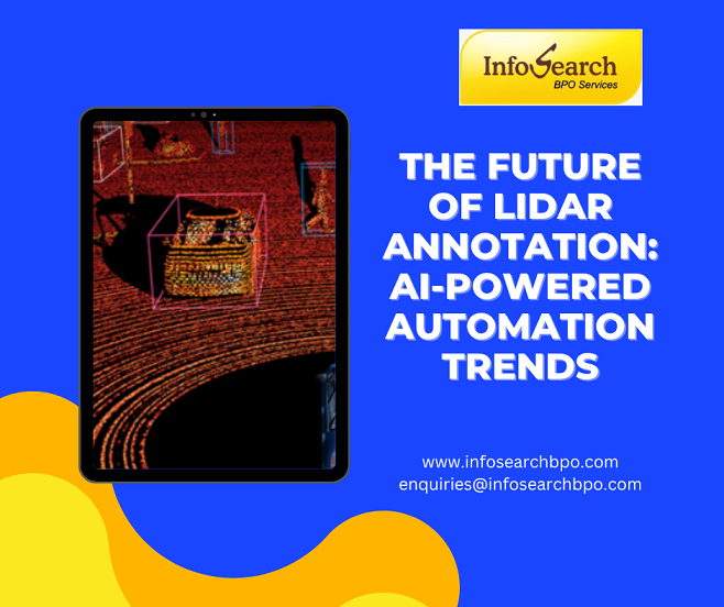
3D Bounding Boxes
A box is drawn in 3D to define the location, size, and orientation of an object.
This is typically employed for the detection of vehicles, pedestrians, machinery, and other objects in 3D space.
Point-Level Semantic Segmentation
Each point is marked with a category.
In the case of a road, for instance, the points could be classified as road; similarly, points that belong to a vehicle could be classified as vehicle.
Instance Segmentation
Besides classifying objects, instance segmentation is able to distinguish individual objects of the same category.
For instance, in a system that recognizes that all the products are cars, it may be possible to distinguish between Car 1, Car 2, and Car 3.
Object Tracking
If the LiDAR data is collected in a sequence, objects can be tracked over more than one frame.
It facilitates AI systems to grasp changes in movement, direction, and surrounding conditions over time.
Each of these techniques could be used for different applications of the final AI model.
The reasons behind the growing necessity for automation
The amount of information that autonomous vehicles and other systems that utilize sensors can gather on a daily basis can be enormous. It can take a lot of time and effort to manually annotate all the points in a complicated 3D scene.
There can be thousands or millions of points in a single environment. As there are more frames, more views of the sensor, and more categories of objects, the workload grows quickly.
Manual annotation can scale to be challenging.
That’s why AI-powered automation is making an impact in the LiDAR annotation workflow.
The automated systems can analyse the point cloud and create initial predictions that can be used to start every annotation. The human annotators can then check, correct, and approve the results.
This method could help enhance productivity without sacrificing the quality-monitoring required for certain projects.
AI-Assisted Pre-Annotation
AI-empowered pre-labeling is one of the most notable developments in the area of LiDAR annotation.
After training a model, an AI model may be used to automatically detect objects from a new point cloud. It could produce preliminary:
- 3D bounding boxes
- Object classifications
- Semantic labels
- Instance labels
- Object tracking information
Human annotators then check the predictions.
The automated annotation might need some minor corrections for simple and familiar objects. More complex objects can be shown in greater detail.
For instance, an AI system might be able to recognize the vast majority of vehicles in a road scene, but might have trouble with:
- Partially hidden pedestrians
- Unusual vehicle shapes
- Construction equipment
- Objects at long distances
- Poorly captured point clouds
- Overlapping objects
These exceptions can be managed by human reviewers.
This establishes a flow in which automation can speed up the first part, and people take care of the validation and quality aspects.
The rise of Human-in-the-Loop Annotation
He does not expect 100% automation in the future of LiDAR annotation.
Point cloud information may be very complicated. Objects can overlap, be partially visible, be different shapes when viewed from different angles, or have an insufficient number of points to classify accurately by an automatic system.
This is where a Human-in-the-Loop approach comes into play.
In a typical workflow:
- AI produces a preliminary tagging.
- Human annotators check the prediction.
- Incorrect labels or bounding boxes are corrected.
- If the case is complex or ambiguous, then it is reviewed again.
- Validated data is fed back to the AI Development pipeline.
The corrected data can then be used to make a better automated model for the future.
This forms a cycle over time.
As the quality of training data increases, automated pre-labeling could improve in accuracy. With the advancement of automation, human experts can dedicate less time to repetitive tasks and more time to challenging cases.
Such a mix of AI speed and human expertise will probably shape the future of LiDAR data annotation.
Active Learning: Annotating the Data That Matters Most
Active learning is another significant development.
These traditional workflows of annotation can label a massive amount of data without taking into consideration if each example is driving equal value to the AI model.
Active learning can be used to narrow down which are the most useful (or most unclear) examples.
An AI system can be very confident, for instance, in spotting a car under bright daylight where it is well lit and clearly visible. This may not be helpful for another thousand identical instances.
But this model might have trouble with:
Weather conditions during heavy rain with vehicles
- Pedestrians at night
- Road construction zones
- Unusual traffic conditions
- Rare vehicle types
- Partially obscured objects
These are cases that are uncertain or unusual, and an active learning system can detect and flag them for human annotation.
This can provide a more strategic approach to annotating.
Rather than just asking “How much data can we annotate?” AI firms can start asking “How can AI help us annotate more data?”
“What information will yield the greatest benefit to the model?”
The change may have a major impact on the processing of future LiDAR data sets.
Auto annotation for 3D Bounding Boxes
One of the most prevalent types of LiDAR annotation is the 3D bounding box and Infosearch provides it, especially in the field of autonomous driving and robotics.
The manual creation of these boxes involves making an estimation by the annotator:
- Object position
- Length
- Width
- Height
- Orientation
With AI tools gaining in accuracy, they can now aid in this process by identifying objects and creating a preliminary 3D box.
The annotator can then tweak the box, if needed.
Automation may be particularly effective for frequently occurring objects such as:
- Cars
- Trucks
- Buses
- Pedestrians
- Cyclists
But for some unusual or complex objects, much still must be done by hand.
In the future, therefore, the process is likely to be automatic box creation and manual validation, instead of manual box creation.
Automated Semantic Segmentation
One more field where AI-driven automation is likely to be a growing player is semantic segmentation.
Machine learning models can be used to predict what type of area is represented by each point in a point cloud, rather than manually labelling each point.
A system can look for, for instance:
- Road surfaces
- Sidewalks
- Buildings
- Vegetation
- Vehicles
- Pedestrians
- Traffic infrastructure
Human annotators can then review the predictions and fix up any mistakes.
This can greatly decrease repetitive work, especially in massive data sets with similar environments.
But segmentation is far from ideal if the training data is not diverse.
A model that is well-trained in urban settings could not be effective in a rural, industrial, rare weather, or an unknown infrastructure setting.
These more challenging scenarios will require human annotation to continue to expand datasets.
Multi-sensor fusion is revolutionising the way the data is annotated
LiDAR will not be the only technology that will drive the future of autonomous systems.
There are numerous types of AI applications that involve multiple sensors, such as:
- LiDAR
- Cameras
- Radar
- GPS
- IMU sensors
This method is also known as sensor fusion.
The problem is that every sensor gives a different perspective of the surroundings.
Visual details are provided by a camera – colour and texture. LiDAR provides depth and spatial structure. Information on the movement and distance of objects can be provided by radar.
Combined analysis of multiple sensor streams is more likely to be supported in the future by annotation platforms.
This is because an annotator can use a LiDAR point cloud in conjunction with a camera image to better understand an ambiguous object.
For instance, a far-away object could be seen as just a point for LiDAR. A photographic image of the captured object might be helpful to determine if it is a pedestrian, cyclist, sign, or other object.
AI-driven sensor fusion can enhance the precision of annotations by leveraging the best attributes of various sensors.
Temporal Annotation and 4D LiDAR Data
LiDAR annotation is also done frame by frame.
Sequences of point clouds are used to store the information of an object’s movement over time.
This is sometimes referred to as 4D data—where the 3-D space dimensions are augmented with time.
The following are some of the things that future annotation workflows will center on:
- Object trajectories
- Motion patterns
- Object velocity
- Direction
- Temporal consistency
- Long-term object tracking
Affecting the ability of an autonomous vehicle to recognise an object is just as critical as the ability to understand movement.
It is not enough for a vehicle to identify a pedestrian. It might also have to determine if the pedestrian is standing, walking, getting near a road, or moving away.
AI-based tracking can assist with automatically tracking the movement of objects between different frames of LiDAR data, and human reviewers can fix cases where objects are missed, misidentified, or get lost.
This can make it easier to annotate each frame individually.
Identify the types and characteristics of synthetic data and LiDAR-based annotations
The other major trend is the growing usage of synthetic data.
Generally, synthetic data is generated in a simulated manner, not from the real world.
A virtual environment can give rise to thousands of scenarios of:
- Different road conditions
- Weather patterns
- Lighting environments
- Vehicle types
- Pedestrian behaviour
- Rare safety scenarios
The fact that the identity and location of each digital object are known to the system makes it possible to produce a synthetic data set automatically by creating the annotations.
But synthetic data isn’t likely to fully supplant real-world data.
To ensure that AI models trained solely in simulated environments are effective in real-world scenarios, it is important to acknowledge that they are not always as effective as they would be when trained in a real environment. Real environments are full of unpredictable variations, sensor noise, and odd objects, as well as unexpected situations.
The future will probably be a mix of:
- Real-world LiDAR data
- Synthetic data
- AI-assisted annotation
- Human validation
The hybrid solution can help to enhance data diversity and lessen the amount of manual-only annotation that needs to be done.
Automation will help increase consistency
These projects can involve hundreds of thousands or even millions of objects to be annotated.
A consistency problem exists in trying to adhere to the same quality in these datasets.
Tools that use Artificial Intelligence (AI) can be helpful in this regard, as they can also use that initial logic on a large amount of data.
For instance, a model trained to identify a specific class of cars can be used across the entire training set without any variations.
But automation doesn’t ensure accuracy.
If the underlying model has learned a wrong pattern, then it may repeat this incorrect pattern over and over again.
That’s why quality control is still important.
Future workflows will probably be a hybrid between consistency and manual checks.
An automated system can detect possible anomalies, and a human system can check the correctness of the annotation.
The quality control will be made more intelligent.
Quality assurance is also changing.
Manual random reviews may not be sufficient, so AI may be able to assist with finding annotations that warrant more scrutiny.
An automated quality system can identify:
Boxes that are not square or rectangular.
Objects that don’t appear between frames
- Inconsistent object labels
- Unusual point classifications
- Tracking errors
- Low-confidence predictions
This enables quality teams to concentrate their efforts on those areas that are most likely to have mistakes.
With the increasing size of datasets, intelligent quality assurance could be just as vital as automated annotation.
It isn’t about getting data just faster. The goal is to detect issues that could impact the final AI product.
The Role of Annotation Guidelines in an Automated Future
With the growing use of automation, well-defined rules for annotation will become even more crucial.
The logic that can be reproduced by an AI model is the logic it has learned from existing data.
The automated system can also produce inconsistent predictions if original annotation instructions are inconsistent.
Good LiDAR annotation projects need to be informed by good answers to questions like:
What is considered a “vehicle”?
How to label partially visible objects?
Where is the starting point of a 3-dimensional bounding box, and where is the ending point of a 3-dimensional box?
How to deal with overlapping objects?
When is an object unknown?
If a person sees an object that’s far away or not very dense, how does that person classify it?
These guidelines serve as the basis for human and automatic annotation.
Better AI models are not the only factor in the future of automation, though, as better annotation standards will be key as well.
The need for industry-specific LiDAR data sets has been growing
LiDAR is currently one of the most popular applications, but it is not the only one for autonomous driving.
The demand for LiDAR annotation is expected to expand among the following sectors:
Robotics
Robots have to be aware of their 3D surroundings.
Annotated LiDAR data can help robots identify objects, navigate spaces, and avoid obstacles.
Warehousing and Logistics
AMRs can leverage spatial data to move around in warehouses, detect obstacles, and assist with material handling.
LiDAR annotation can be used to train systems to identify pallets, shelving, equipment, workers, and more.
Smart Cities
In urban planning, LiDAR and 3D mapping can assist in planning, urban design, and infrastructure development.
Construction
Point cloud data can be utilized to generate a digital model of construction sites and buildings.
AI models can utilize labeled data in order to detect structures, equipment, and changes over time.
Agriculture
Agricultural environments, crops, terrain, and vegetation can be captured using a LiDAR-equipped drone and ground-based system.
Security and Surveillance
3D sensing technologies can be used in the context of perimeter monitoring and object detection in complex environments.
Requirements for annotation will be more specific as LiDAR applications grow.
A dataset of an autonomous vehicle will have different types of objects and annotation rules than a warehouse dataset.
This has led to an increasing need for annotation teams that are flexible and can change to meet industry needs.
What’s the future of LiDAR Annotation?
With the creation of more substantial and complex datasets in AI projects, companies are looking for annotation partners who can scale with precision.
InfoSearch BPO offers annotations and 3D point cloud services, which can be used to support AI and computer vision applications like autonomous systems, robotics, and mapping.
It can be annotated with:
3D Bounding box annotation
- Point cloud labeling
- Semantic segmentation
- Instance segmentation
- Object classification
- Object tracking
- Image and video annotation
- Keypoint annotation
- Polygon annotation
If your business relies on large datasets from LiDAR, it’s likely to be a while before you have to settle for one particular format.
AI Pre-labeling can be useful for some projects. Other cases might need to be manually annotated. Many will need a mix of automation, trained annotators, and multi-level quality control checks.
To enable this changing model, InfoSearch BPO can combine human annotation with scalable technology-based workflows.
The vision is to support businesses in creating high-quality training data and to keep pace with the rapid pace of AI innovation and expansion.
Labeling, a manual, time-consuming task, makes way for intelligent data pipelines in the Future.
Perhaps the most significant shift in LiDAR annotation lies in the shift from considering annotation as a stand-alone manual task.
In the future, annotation will become part of an intelligent data pipeline to a greater extent.
It might be something like this:
- Raw spatial data is captured by LiDAR sensors.
- AI can automatically recognize familiar objects.
- Examples of low confidence or unusual examples are prioritised.
- Human annotators check and fix the data.
- Automated quality tools identify possible inconsistencies.
- The validated data is fed into the AI model to enhance it.
- Better annotations for future data sets are produced.
This sets up a continuous improvement cycle.
Future systems will be increasingly capable of aiding the annotator, rather than annotating each point cloud individually.
Human expertise will still be required, but the scope of that expertise may be different.
Repetitive labeling tasks will be reduced for annotators, and they will have more time to deal with ambiguity, validate challenging cases, enhance guidelines, and perform quality control.
Conclusion
The future of LiDAR annotation is linked to developments in AI as a whole.
With the rise of autonomous vehicles, robotics and smart infrastructure, and spatial computing, the need for accurately annotated 3D data will also keep increasing. Meanwhile, with the number of LiDAR datasets and their complexity increasing, there will be a growing need for more automation.
Pre-labeling, active learning, sensor fusion, automated quality checks, object tracking, and synthetic data are all aiding the transformation of the annotation workflow with the help of AI.
But full automation is not going to be the solution.
Rare events, ambiguous objects, quality-sensitive applications, and complex environments still require human judgment. The future will hence be in the Human-in-the-loop model where the AI contributes to increasing speed and scalability, and the human annotators bring accuracy and accountability.
When it comes to the development of AI-powered autonomous and spatial systems, it will no longer be a matter of just gathering more data. It will be creating smarter data pipelines that will recognize the right data, automate the repetitive task of making annotations, leverage human expertise where it is needed most, and constantly fine-tune the model performance.
The future of LiDAR annotation is not human vs AI, but rather human and AI combined to create more intelligent, reliable, and scalable systems.
Contact Infosearch for your data annotation services.




Recent Comments